
Tropical Storm Erin 2025 Could Become a Hurricane This Week
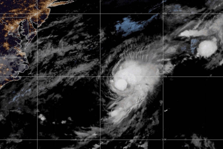
As of 5 a.m. EDT on Tuesday (Aug. 12), the storm’s center was about 690 miles (1,110 km) west of the Cabo Verde Islands. Erin is moving west at 22 mph (35 km/h) with maximum sustained winds of 45 mph (72 km/h).
The NHC expects Erin to continue moving west before gradually slowing and turning toward the west-northwest. If current trends hold, Erin could become a Category 1 hurricane within two days.
No Coastal Warnings in Effect
The NHC has not issued any coastal watches or warnings at this time since Erin remains far out in the Atlantic Ocean.
However, forecasters warn that tropical systems can change direction unexpectedly. Residents in the Caribbean and along the southeastern U.S. coastline should monitor official updates and prepare for potential impacts if the storm shifts closer to land.
Gulf of Mexico: Heavy Rain and Flood Risk
A separate weather system is bringing disorganized showers and thunderstorms to the north-central Gulf of Mexico. This disturbance, linked to a surface trough, has little chance of developing into a tropical cyclone.
Still, heavy rain could lead to flash flooding in:
- Florida Panhandle
- Southern Alabama
- Southern Mississippi
- Southeastern Louisiana
The NHC warns of possible road closures, dangerous driving conditions, and localized flooding in low-lying areas.
Low-Pressure System Near Nova Scotia
Another system, a non-tropical low located several hundred miles southeast of Nova Scotia, Canada, is producing showers and thunderstorms west of its center.
It has a small chance (10%) of developing tropical or subtropical characteristics while passing over the warm waters of the Gulf Stream. By midweek, the system will likely move north over cooler waters, ending development chances.
What Is a Tropical Storm?
A tropical storm is a rotating system of thunderstorms with maximum sustained winds between 39–73 mph (63–118 km/h). If winds reach at least 74 mph (119 km/h), it becomes a hurricane.
Hurricanes can cause significant damage, from coastal flooding and storm surges to widespread infrastructure losses. Category 1 storms can cause minor to moderate damage, but higher categories can be catastrophic.
Safety Tips from NHC
The National Hurricane Center advises coastal residents to:
- Track official forecasts and advisories.
- Review emergency plans and evacuation routes.
- Prepare an emergency kit with essentials.
- Avoid spreading unverified weather rumors online.
Note: This forecast is based on NHC data as of Aug. 12, 2025, 5 a.m. EDT. For real-time updates, visit the NHC official website.
Source: National Hurricane Center
